
25 North Dakota Scenic Riding Locations
Spend a summer taking byway and backway photos and create lasting, scenic memories.
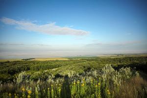
From the Killdeer Mountains to the deeply entrenched Little Missouri River Breaks and Badlands, this byway provides a unique and enchanting landscape in one of the most scenic areas of western North Dakota. The rich culture and history of the Mandan, Hidatsa and Arikara tribes, paired with the recreational opportunities of Little Missouri State Park, provide visitors an enthralling adventure.
Hwy 22
Killdeer, ND
United States
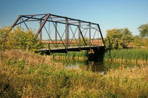
Old Red Old Ten Scenic Byway was appropriately designated as North Dakota's tenth state byway. Originally referred to as the Red Trail that became Old Highway 10, this byway provides ample opportunity to explore how life was many years ago for those who settled in North Dakota. The culture of the Native Americans and European pioneers are captured along this route. Travelers can tour several regional and local museums.
Old Hwy 10/Old Red Trail
Mandan, ND
United States
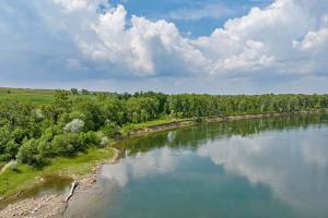
This byway highlights fantastic views of the Missouri River Valley along with some of the state's most outstanding Lewis and Clark destinations. Visitors are able to follow the course of this great journey and discover the history and culture of the people who lived in the rolling hills and wooded valleys of the Missouri and Knife Rivers.
Hwy 200
Washburn, ND
United States
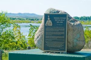
History comes alive on a journey along the Missouri River as the great Lakota spiritual leader Sitting Bull lived and died here; Meriwether Lewis and William Clark stopped 14 times; famous mountain men like Jim Bridger and Jedediah Smith passed through; and it is documented as the final resting place of Lewis and Clark's guide Sakakawea.
Hwy 1806
Cannon Ball, ND
United States

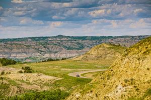
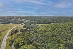
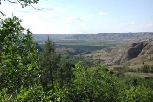
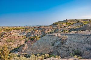
This byway provides the colorful North Dakota Badlands as a scenic backdrop with its sweeping vistas of one of the last remnants of wilderness in the Northern Great Plains. Theodore Roosevelt National Park memorializes the 26th President for his enduring contributions to the conservation of our natural resources. Visitors have unique opportunity for wildlife viewing.
217 Scenic Dr
Watford City, ND
United States
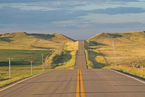
This byway begins its upward ascent winding through the calm, serene beauty of the Turtle Mountains passing farmsteads, pasture land, recreational areas, beautiful clear blue lakes, tree covered wildlife areas and then descending into the foothills with a spectacular view of the prairie. Rich in history, this area provided trading and trapping for the early settlers.
Hwy 43
St. John, ND
United States
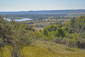
More than 12,000 years ago glacial melt formed the James River Valley. When travelers descend the byway into the valley, they can see the panoramic view of a winding river surrounded by tall grass prairie and wildflowers. This area is rich in Native American history, earthen mounds, early settlement and scenic beauty.
Hwy 46 S of Jamestown
Jamestown, ND
United States

The most striking experience on this backway is the excellent wildlife viewing opportunities found at the refuge. Over 250 species of birds have been seen here and they include waterfowl, raptors and many other migratory birds. Deer, moose, and other wildlife are also seen along this route.
Hwy 52
Kenmare, ND
United States
This backway located in northeast North Dakota is a special place steeped in history, with natural resources, recreation, scenic beauty, and culture. Winding along the bends of the Pembina River you can enjoy the panoramic view of the Pembina Gorge along with the year-round recreational opportunities of the area.
Hwy 32 to Hwy 55
Walhalla, ND
United States
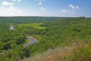
The tree-lined, rolling hills of this valley are speckled with quaint towns and farmsteads, lending to its American charm. In addition to nature and scenery at its best, archaeology, history, culture, and recreation are all found along this byway, North Dakota's first nationally recognized scenic byway.
250 W Main St
Valley City, ND
United States
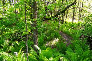
Situated on the meandering Turtle River, Turtle River State Park is located in a beautiful wooded valley. Constructed in the 1930s by the Civilian Conservation Corps, the park offers year-round recreational activities, including camping, picnicking, fishing and trails for hiking, mountain biking and cross-country skiing.
3084 Park Ave NE
Arvilla, ND
United States
Located on the north shore of Lake Renwick, Icelandic State Park offers visitors not only a wide array of recreational opportunities, but also glimpses of North Dakota's homesteading heritage and its natural beauty. Within the park are the Pioneer Heritage Center and restored historic buildings. Also found here is the Gunlogson Homestead and Nature Preserve.
13571 Highway 5
Cavalier, ND
United States

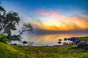
Devils Lake is home to Grahams Island State Park, a 1,122-acre park on the lake's west side. The lake features some of the best fishing in North Dakota, both summer and winter. Amenities at the park, along a loop ride around the lake on highways 57, 281 and 19, include a boat ramp, bait shop, modern and primitive camping facilities and camping cabins.
152 S Duncan Rd
Devils Lake, ND
United States
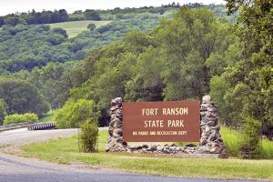
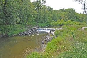
Fort Ransom State Park is managed as a natural and scenic area, and is located on one of North Dakota's officially designated Scenic Byways and Backways, the Sheyenne River Valley National Scenic Byway. Canoeing is popular on the Sheyenne River during the summer, with canoe and kayak rentals available in the park.
5981 Walt Hjelle Pkwy
Fort Ransom, ND
United States
Located on the west shore of Beaver Lake, the park's gently rolling prairie provides scenic views for leisurely walks. In the summer, the lake attracts visitors for boating, canoeing, water skiing and fishing. Beaver Lake State Park is staffed year-round, with camping, picnicking and water-based activities available from mid-May through the end of September.
3850 70th St SE
Wishek, ND
United States

Nestled in the scenic Turtle Mountains on the shores of Lake Metigoshe, the state park is noted for its northern pike, walleye and perch. The rolling hills, aspen forests and small lakes attract nature and photography lovers to the area to capture these sights on film.
2 Lake Metigoshe State Park
Bottineau, ND
United States

On the north shore of giant Lake Sakakawea, Fort Stevenson State Park is known as the walleye capital of North Dakota. A favorite spot for sportsmen to experience the great fishing on the lake, it is home to the Governor's Cup Walleye Fishing Derby, as well as a variety of other fishing tournaments.
1252A 41st Ave NW
Garrison, ND
United States
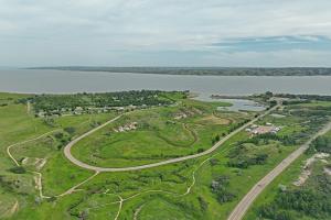
Located on the south shore of Lake Sakakawea, adjacent to Garrison Dam, Lake Sakakawea State Park offers a wide range of water based recreational activities and facilities. The lake itself is one of the three largest man-made reservoirs in the nation. It has a surface area of about 368,000 acres and is 178 miles long, reaching to Williston.
781 Park Ave
Pick City, ND
United States
Located along seven miles of the Missouri River, Cross Ranch State Park is rich in both cultural and natural history. The park is purposely left primitive to preserve the land's natural beauty. The River Peoples Visitor Center has displays and information about the once mighty Missouri River, which has now been tamed through a series of major dams and reservoirs along its length.
1403 River Rd
Hensler, ND
United States
Rich in both military and early Native American history, Fort Abraham Lincoln was once an important infantry and cavalry post. It was from this fort that Lt. Col. George Armstrong Custer and the Seventh cavalry rode out on their ill-fated expedition to the Little Big Horn. On-A-Slant Indian Village. Reconstructed earthlodges depict the lifestyle of the Mandan Indians, who occupied this site from about 1575-1781
4480 Fort Lincoln Rd
Mandan, ND
United States
Some of the most picturesque Badlands scenery can be found at Little Missouri State Park. Most of this primitive park is accessible only on foot or horseback. Electrical hookups are available to campers, however, all other facilities are primitive. Backpacking and horseback riding on the park's over 47 miles of trails are popular activities.
910 103rd Ave NW
Killdeer, ND
United States
Lewis and Clark State Park is on one of the upper bays of Lake Sakakawea. The rugged buttes of the North Dakota Badlands display a towering backdrop to one of the state's best recreation areas. The park, of course, is named for the Corps of Discovery explorers, Meriwether Lewis and William Clark. The expedition camped nearby on April 17, 1805.
4904 119th Rd NW
Epping, ND
United States
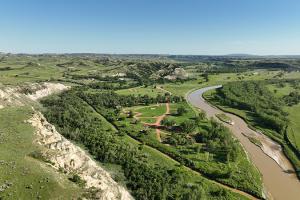
Located in the heart of the North Dakota badlands, Rough Rider State Park is just minutes away from the historic town of Medora and Theodore Roosevelt National Park. This seasonal park is open from April 1 to November 30. In the early spring or during high flows, canoeing the 274-mile long Little Missouri River offers a unique perspective of the badlands from North Dakota's only State Scenic River.
1465 36th St
Medora, ND 58645
United States
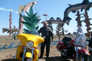
Metal sculptures, including "World's Largest Tin Family," "Teddy Rides Again," "Pheasants on the Prairie," "Grasshoppers in the Field," "Geese in Flight," "Deer Crossing" and "Fisherman's Dream." Gift shop in Regent has miniatures of each statue. Travel highway 30 miles south from interstate to Regent viewing sculptures along the way. More on the Enchanted Highway.
Exit 72 on I-94
Gladstone, ND
United States
The best way to get up close and personal with wildlife and the landscape of the South Unit is to drive the 32-mile Scenic Loop Ride within the park. The route leads to many geographic sites and overlooks and you often will encounter bison near or on the road.
315 2nd Ave
Medora, ND
United States