Accessible Hiking Trails in North Dakota
Wheelchair Accessible Hiking Trails
Boicourt Overlook Trail, South Unit of the Theodore Roosevelt National Park
Surface: Concrete
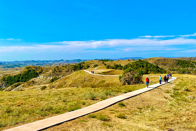
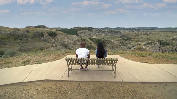
Boicourt Trail is located approximately halfway along the South Unit scenic drive. The concrete paved trail with sitting benches makes for a great stop for people with a variety of abilities from wheelchairs to able bodied. This 0.2-mile wheelchair accessible trail offers some incredible views out over the badlands.

Skyline Vista Overlook Trail, South Unit of the Theodore Roosevelt National Park
Surface: Concrete
Length: 0.1 miles
Skyline Vista Overlook is a 0.1-mile paved, flat nature trail on Johnson’s Plateau. The hike on the 0.1-mile accessible trail to the overlook treats visitors to wonderful views of the Little Missouri River, the western horizon, and the surrounding badlands.
Prairie Nature Trail, Audubon National Wildlife Refuge
Surface: Hardened Gravel
Length: 1.0 miles
The flat gravel trail winds through grasslands and glacial remnant prairie potholes, allowing visitors to observe native grasses and wildflowers, birds, and other animals.
Northern Cass Pass, between Hunter and Arthur
Surface: Asphalt
Length: 6 miles
This rail trail provides a straight north-south route connecting the friendly, rural communities of Arthur and Hunter, about 35 miles from Fargo. As it parallels Old Highway 18, the pathway offers a non-motorized alternative to the roadway for pedestrians, wheelchairs, and bicyclists.
Washburn Discovery Trail, Washburn
Surface: Concrete
Length: 2.2 miles
The Washburn Discovery Trail is part of the Lewis and Clark National Historic Trail and begins at North Dakota's Lewis & Clark Interpretive Center. From there, the paved pathway heads toward the Missouri River and winds along its tree-lined bank, ending at Riverside Park, where you'll find the historical Sioux Ferry, once a stop for riverboats traveling from St. Louis, Missouri.
Cavlandic Trail, between Cavalier and Icelandic State Park
Surface: Asphalt
Length: 6.5 miles
The 6.5 mile asphalt trail sits on the north side of State Highway 5 linking the town of Cavalier to Icelandic State Park. Parking for trail users is available in on the street in Cavalier and at Icelandic State Park. The trail remains mostly flat throughout the 6.5 miles.
Cartwright Tunnel & Fairview Lift Bridge, Yellowstone River Northwest North Dakota
Surface: Pavement (parking lot and approach), Steel Mesh (bridge), Dirt (tunnel)
The Fairview Lift Bridge was designed with a section that would lift to accommodate steamboat travel on the river. The bridge carried both cars and trains across the Yellowstone near the Montana border. The Old Fairview Bridge and Cartwright Tunnel Trail is now open to pedestrians and cyclists to cross the Yellowstone River in North Dakota. Because it is a rail-trail the only elevation change is a slight grade from the parking lot to the trail.
Minot Outdoor Recreation Area
Surface: Pavement and Gravel
Length: 2 miles accessible paved, 5 miles total
This beautiful spot is the perfect place to go hiking or biking on 5 total miles of trails and 2 miles of accessible paved and gravel trails featuring a scenic view of the prairie landscape and diverse native plants and animals.
Limited mobility, non-wheelchair approved
Matah River Trail, Cross Ranch State Park
Surface: Groomed grass and dirt
Length: 2.9 Miles
This 2.9-mile trail begins at the Visitor Center and loops around the park’s main use areas. Along the river, interpretive signs describe the history, wildlife and geology of the area.
Denbigh Trail, Denbigh Experimental Forest
Surface: Dirt
Length: 3.0 Miles
The Denbigh Trail is a 3-mile loop that winds through tree plantings and surrounding prairie at the Denbigh Experimental Forest. It includes a small loop through the historic arboretum.
Flicker Loop, Fort Stevenson State Park
Surface: Dirt
Length: 2.3 miles
Flicker Loop is a short trail includes gorgeous views of the shoreline of Lake Sakakawea and goes through some level wilderness.
Wind Canyon Trail, South Unit of the Theodore Roosevelt National Park
Surface: Gravel
Length: 0.4 miles
This short loop trail travels along wind eroded cliffs above the Little Missouri river, before climbing up to a dramatic lookout point.
Little Twig Trail, Fort Ransom
Surface: Dirt
Length: 0.9 miles
The Little Twig Trail meanders through a lowland woodland community. The trail twists and turns through oak woodlands and grassy meadows.
Eskers Trail, Lewis and Clark State Park
Surface: Dirt/grass
Length: 2.6
Easy nature trail along Lake Sakakawea and then through some open fields in a badlands landscape unique to North Dakota.
Missouri River Natural Area Trail, Mandan
Surface: Dirt
Length: 5.0 miles
Located on the east side of Mandan along the Missouri River, this 157-acre preserve is a pristine floodplain woodlands. A mostly leveled out and back dirt trail that runs along the river.
