
14 Great North Dakota Snowmobile Trails
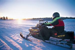
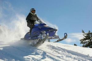
Snowmobile trails criss-cross much of the state of North Dakota. Snowmobile North Dakota features a system of 14 trails on which to enjoy an afternoon of great riding, alone or with a few select friends. Take your pick of scenic routes, or try them all.
Snowmobile enthusiasts can now download the new Snowmobile North Dakota app to track trips, track current location on a trail using GPS, get updates on trail conditions, locate nearby amenities, and save and load itineraries. The basic version is free to download on both Apple and Android products and does not require data usage.
The new interactive trail map is also available online and includes the same trail status features and amenity icons as the mobile app, and also has a Plan Your Trip function providing turn-by-turn directions and total mileage from point A to point B as selected by the user.
Online trail maps and current trail conditions can be found here

The Sno-Trails system includes Bottineau, McHenry, Renville and Ward counties and is located around the Minot area.

The Peace Garden Trail system includes Bottineau and Rolette counties. In the north-central part of the state, trail runs through the Turtle Mountains, creating a beautiful scenic ride. This trail system connects with the Canadian trail system at Carbury Port and at the International Peace Garden. The International Peace Garden and the Lake Metigoshe State Park are located on the trail system.
The North Central Trail system includes Benson, McHenry, Pierce, Ramsey and Towner counties. The riding is 80% cross country with the other 20% ditch riding. The trail gives the rider a great cross section of terrain that North Dakota has to offer.

The Lake Region Trail system includes Nelson and Ramsey counties. The trail system is centered on the city of Devils Lake in the northeast part of the state. A day of riding may include tight twisting trails, wide open lake runs and long straight sections of country road ditches. Heated and lighted warming houses are located in strategic points on the trail system.
The Northeast Trail system includes Cavalier, Pembina and Walsh counties. Known as the Pembina Gorge Trail, it is located in the northeast corner of the state. The Gorge itself is a must-see natural phenomenon. This system ties into the Canadian trail at three major points and also ties into two major Minnesota trails. This trail offers miles of riding and usually has very good snow.

The Red River North Trail system includes Pembina and Walsh counties. The western half is mainly ditch and shelter belt riding and the eastern half follows the Red River and the woods from Park River to Hoople. This trail association provides many places to stay for travelers on a snowmobile trip. The Red River North Trail system has a lot to offer snowmobilers who are looking for fun and relaxing snowmobile trips with the variety of riding and many miles of trail.

The Red River South Trail includes Grand Forks and Walsh Counties. The Red River South Trail Association grooms miles of marked snowmobile trails in the northeastern part of North Dakota.

The Cattail Trail system includes Barnes, Cass, Steele and Traill counties. The Cattail Trail offers trail traveling through field, woods, lakes, prairies, sloughs and ditches. There are also fuel stops, restaurants and bed and breakfasts.

The East Central Valley Trail includes Cass and Richland counties. The trail system is in the southeast portion of North Dakota and primarily covers Cass County. It is about 20 miles from two different points on the Mayville-Portland Trail System (21 miles from Hillsboro and 17 miles from Galesburg). This trail also connects to two Minnesota trail systems managed by the Clay County Trail Blazers and Felton Roughriders.

The Southern Valley Trail system includes Richland County. It has miles of groomed snowmobile trail kinking nearly every city in Richland County.
The Sargent County Trail includes Richland and Sargent counties. The trail offers miles of riding in the southeastern portion of the state. Each community has restaurants, gas stations, motels, grocery stores and snowmobile repair shops.

The Sheyenne Valley Trail system includes Barnes, Dickey, LaMoure, Ransom and Stutsman counties. The Sheyenne Valley Trail is located south of Jamestown and Valley City. There is a wide variety of riding in this system. The trail follows the Sheyenne River bottom and the James River. It also has ditch riding, shelter belts, and wide open fields. This takes you through the Fort Ransom State Park and also a park called Little Yellowstone. Several other stops are located along the way.
The Missouri Valley Trail includes Emmons and Burleigh counties. The trailhead is located 1.5 miles south of I-94′s Exit 61 on Bismarck Expressway. This trail runs east 22 miles along Highway 10 to Sterling, where food and gas are available. The trail then turns south to Moffit 10 miles south of Sterling along Highway 83. South of Moffit are the towns of Hazelton (15 miles) and Linton (20 miles) which have gas, food and lodging available. The trailhead is 60 miles north of Beaver Bay.